
Author:
Lutz Pietschker
Version: 2014-06-10
Home Page | Hiking | What's New
Summary:
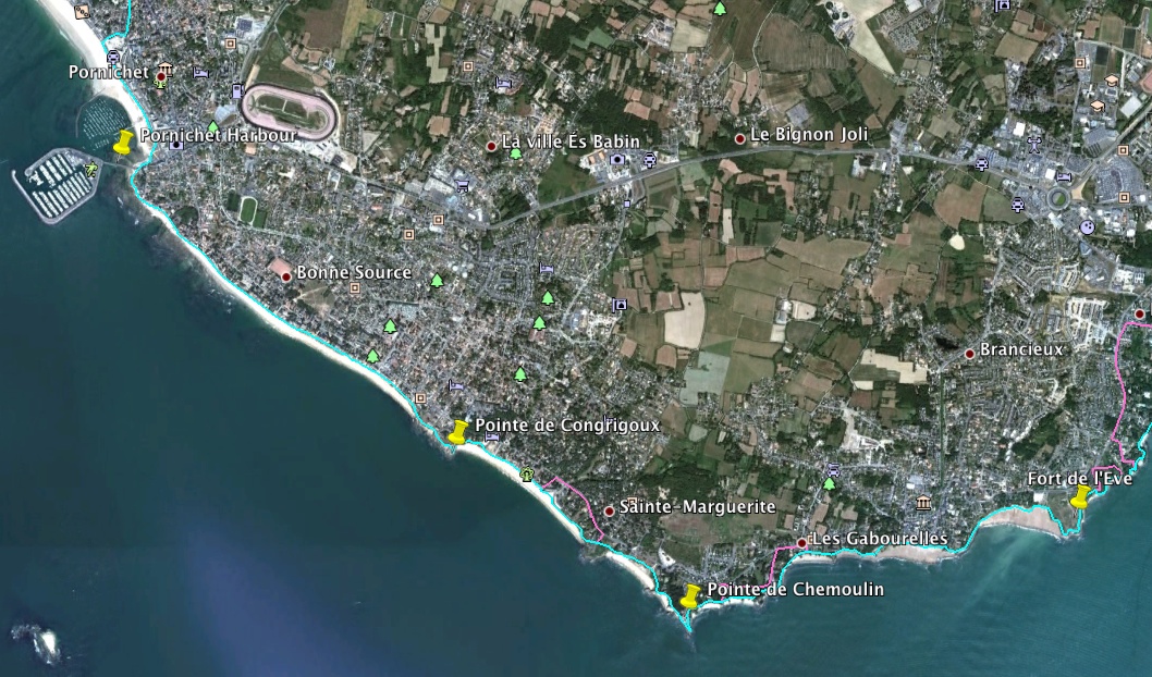
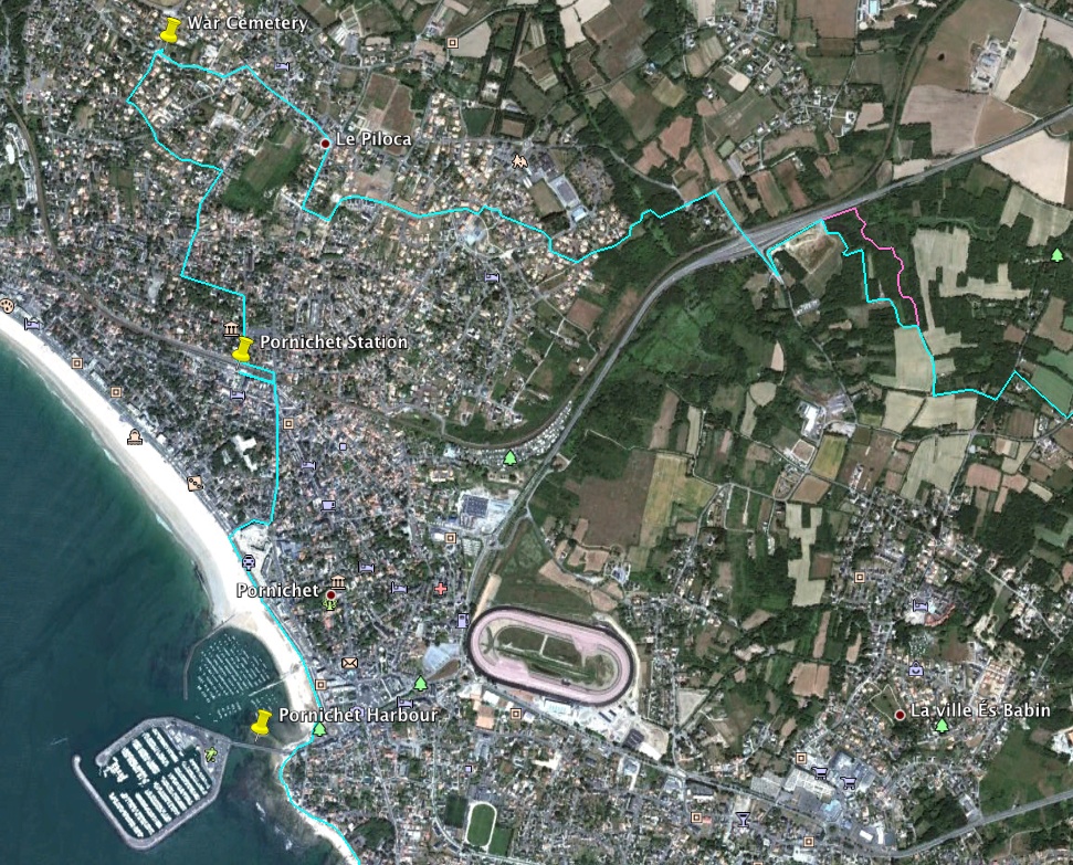
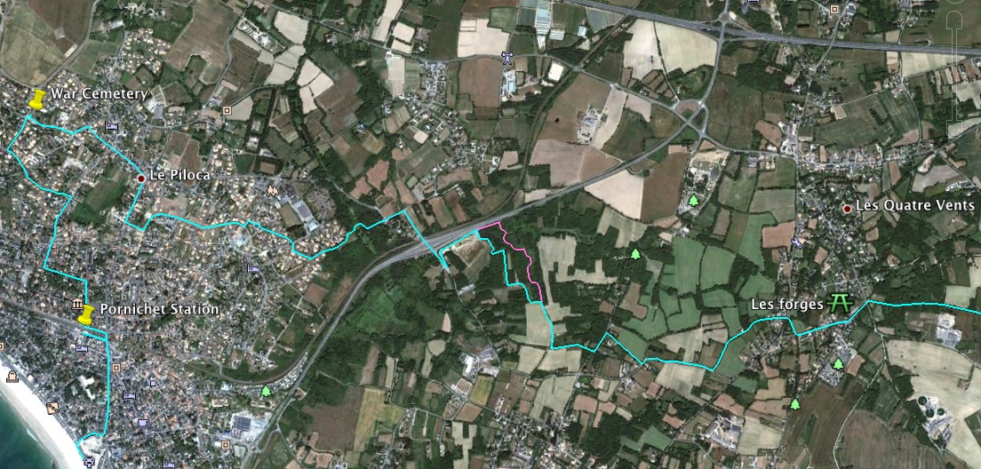
This hike is on the Atlantic coast of France, in the Department Loire-Atlantique, and is a round trip that I started in Saint-Nazaire. The first part is along the coast on the chemin cotier, partly on beach promenades but mostly on an old customs path along the top of a rocky coast broken by small coves with sandy beaches. From the Pornichet yacht harbour I will pass through this seaside resort to the railway station. The second part of the way loosely follows the bicycle path vélocéan through the small-house areas of Escoublac, rural areas, past the Dissignac megalith tumulus and back to Saint-Nazaire through parks.
The history the page title refers to is mostly World War 2 history. I visited Saint-Nazaire for the annual remembrance day for March 28th, 1942, when a British raid (Operation Chariot) destroyed the Forme Ecluse Joubert, also known as the Normandie Dock, in the harbour of Saint-Nazaire. Of the 611 sailors and commandos participating, about one third returned to Britain, one third became German prisoners of war, and one third died. Some of the victims are buried at the British War Cemetery in the village of Escoublac, the destination of my walk.
On my way to Escoublac I saw traces of the "Atlantikwall" bunkers and gun emplacements, some of which played a role in Operation Chariot, but also older fortifications that go back to pre-Napoleonic times, as well as modern signal stations; this part of the coast has always been in the focus of nations struggling for predominance on the European Atlantic coast and the western approaches to France and Britain, and traces of that struggle are present everywhere.
Further information:
I planned my route largely based on what "looked good" on Google Earth and on the topographic map, I do not claim that it is the best or most interesting route for this walk.
My own route was more like 39 km because I had to take some detours on the way to Pornichet; on the coastal path they were forced by construction works and because some beaches are not accessible at high tide. The tracks in the above files show the detours I took; they are not a recommendation but may be necessary, as shown or similar, when you try to follow my route, so you better plan for some extra kilometres above the 34,5 stated above.
The detour on the way back was an error on my part that lead me into a waterlogged area; I expressly do not recommend to use it, though it gave the walk a nice touch of the adventurous.
Sections:
Hints:
Clicking a thumbnail opens the image in this window; in most browsers a shift-click will open the image in a new window.
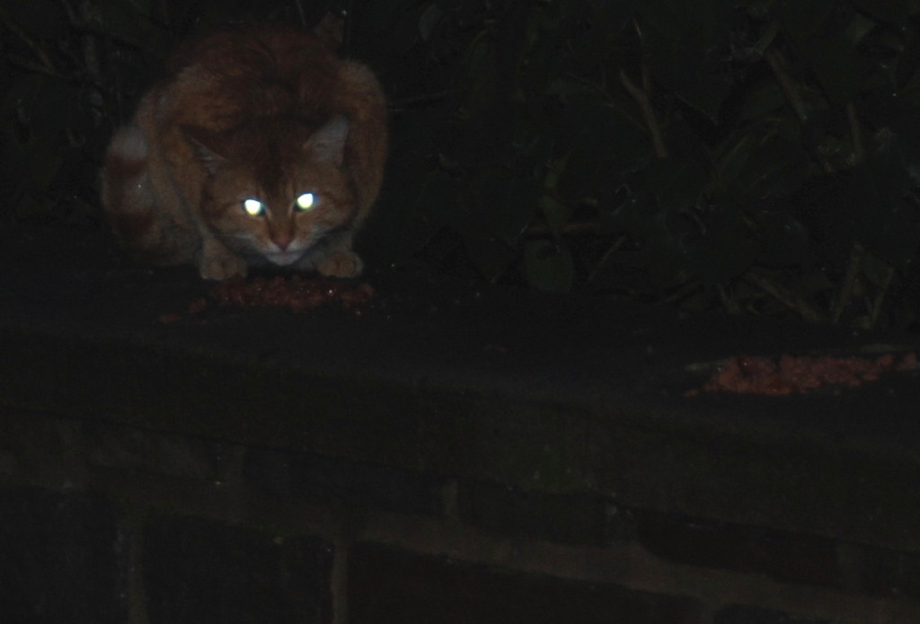
This hike started rather early in the morning, but someone else was up already.

The 4 clocks as they look today

The Operation Chariot Memorial

Historic houses on the boulevard Wilson
The 1917 AEF memorial statue
Dip-fishing pêcheries, …

…in the foreground, the Mae West model
Fort de Villés-Martin; pre-Napoleonic
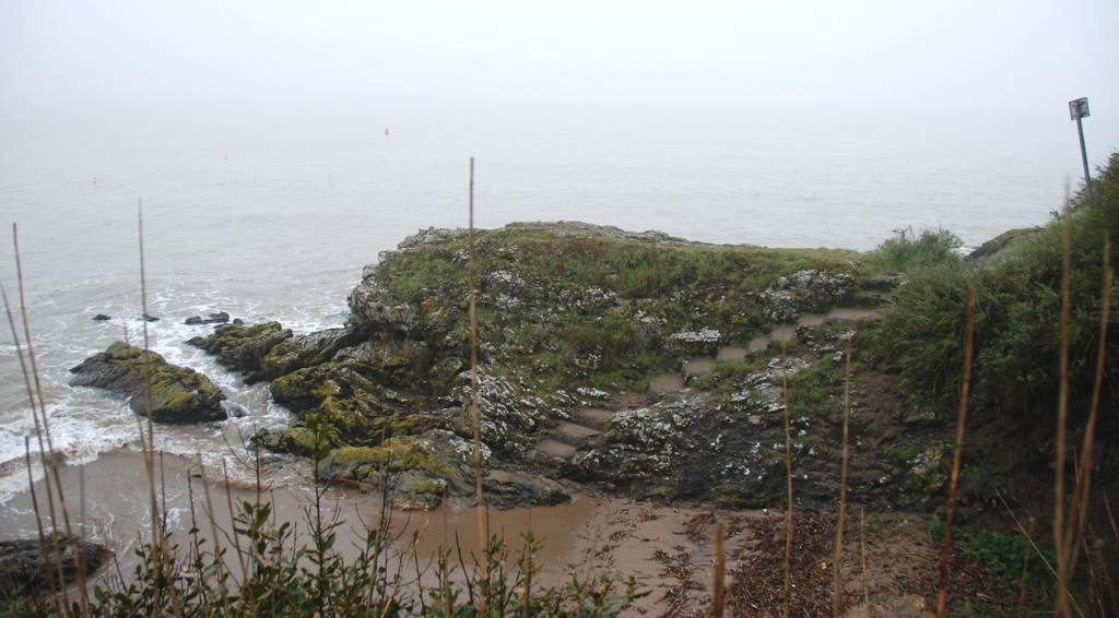
An ideal smuggler's cove, it seems
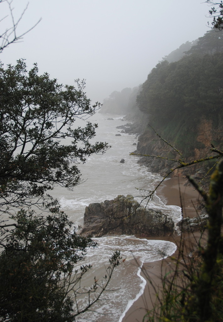
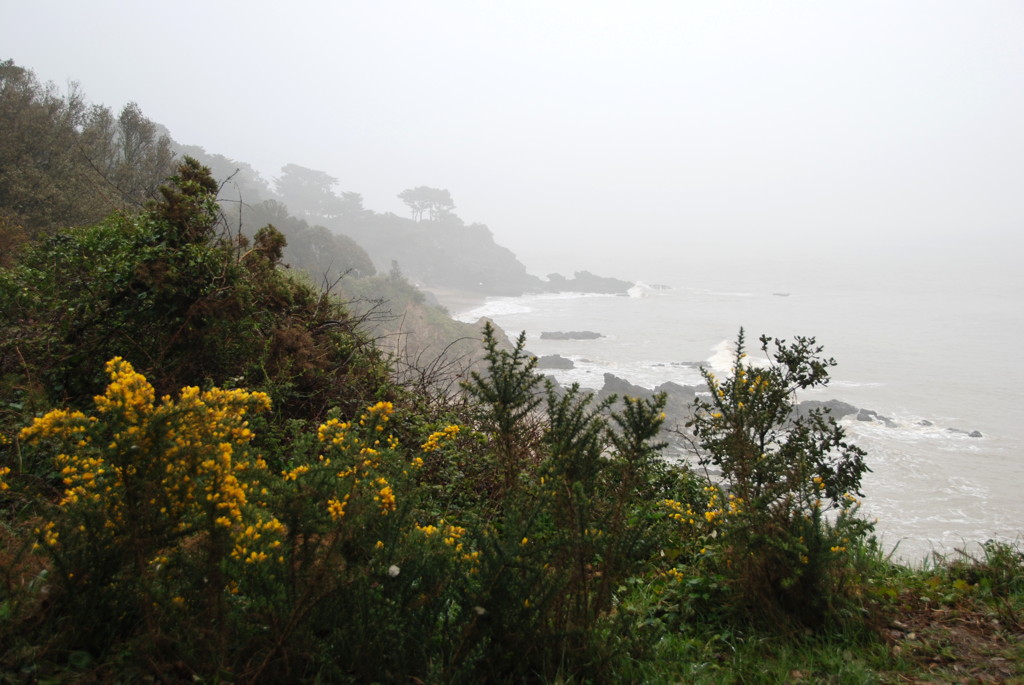
Rocky coast in the mist
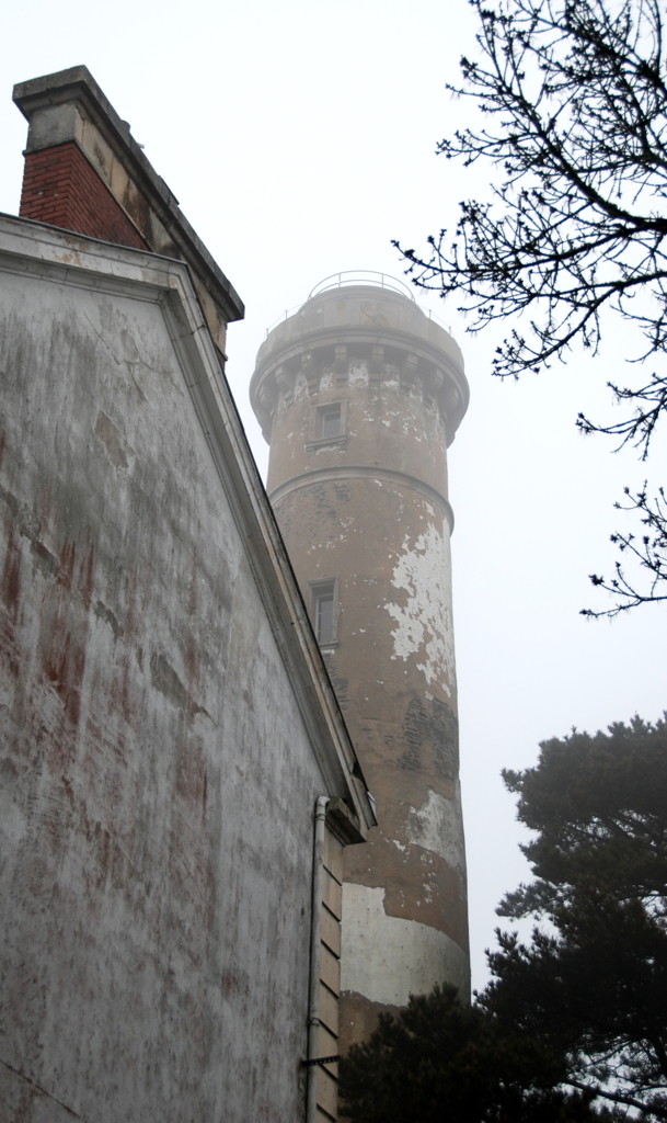
Lighthouse "tour du commerce", Porcé
All wet and green

No footpath left on the beach
pêcheries, Port-Gavy
phare de l'Aiguillon
A look towards the pointe de l'Eve

The 170 mm gun emplacements at pointe de l'Eve; 75 mm guns were placed in open emplacements inland.
Looking back from the pointe de l'Eve; note the bunker in the cliff
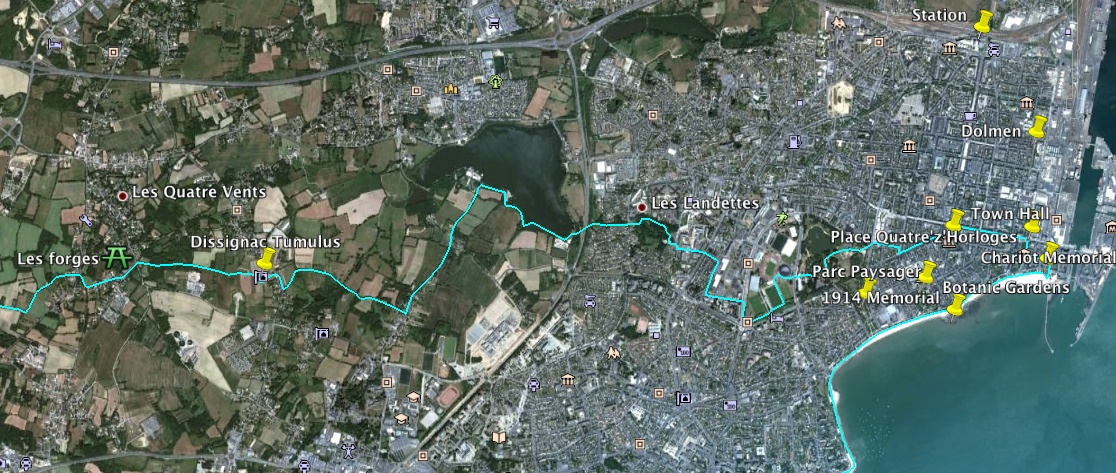
I started my trip near the Place Quatre z'Horloges, the place of the 4 clocks (I was not able to find out whether this spelling is historic or a Breton touch). Because I wanted to take some sunrise photos on the coast, I started out at 06:00. There was light rain that fortunately ceased after the first two hours, though it remained just wet enough to discourage me from taking many breaks.
A short eastward leg took me to the foot of the western jetty of the avant port, a basin sheltering the "new entrance" (constructed in 1900) from the Atlantic; I felt that I could not take a hike from Saint-Nazaire without even touching the harbour area. Near this place, on the beach promenade, is a memorial place for the sailors and soldiers of the commando raid known as Operation Chariot, a menhir with a memorial plaque and a gun of HMS Campbeltown, the destroyer that was blown up to destroy the dock gate. There is an annual celebration, a moving ceremony, at this place in remembrance of the British and French who died that day.
The commando raid of March 28th, 1942 is what triggered my interest in Saint-Nazaire and lead to my visits to the town.
I will go deeper into the history of the town itself, including details about the raid, in my companion web page, A Walk in Saint-Nazaire. Also near the east end of the beach promenade is another memorial for the victims of both world wars.
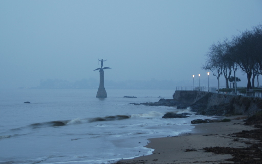
The westward walk along the beach promenade, parallel to the boulevard du President Wilson (formerly boulevard de l'Océan), gives a fine view of the long beach that has been used as a target of excursions and a bathing beach by Nazairiens and tourists for more than a hundred years. Along the boulevard there are some of the very few real old buildings of Saint-Nazaire; about 85% of all buildings were destroyed in the course of the 2nd World War, by the German occupants and by aerial bombardments. Some (like the church) were re-built in their original form, but much was lost forever in the post-war years when the urgent need to provide housing and an infrastructure for the citizens returning from a forced exile was paramount, leaving little room for the luxury of conservation. Adjacent to these old buildings is the Botanic Garden, and out in the surf is a monument for the U.S. troops of the American Expeditionary Force that landed here in 1917 to help France and Britain in the Great War. On this picture you can see the troops marching on exactly the promenade I am standing on.
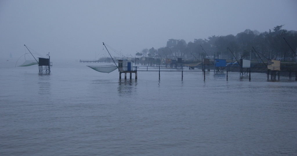
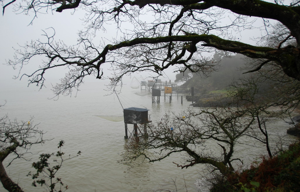
Where the promenade curves southward, the sand beach gives way to a promenade and many pêcheries, small huts on stilts with a boom to lower and raise a square dip-net for fishing. You drop the net to the sea ground, raise it after a few minutes and collect whatever fishes have been careless enough to be above the net in just that moment. Three to four dips used to provide enough for a family meal even 50 years ago, but yields have gone down these days. Still, you see these nets all along the coast of Brittany and even on the harbour jetties of Saint-Nazaire itself.
Soon, at the modern, stainless-steel "sculpture du vent", the way turns westward to another beach and the Villés-Martin lighthouse, one of the many lighthouses on this coast. This one, like some others, has been built built some way off the coastline, near the actual shipping lane.
The historic fort de Villés-Martin is one of the few pre-Napoleonic buildings that have survived, though even this place is littered with World War 2 concrete constructions. It was erected as early 1756 by the governor of Brittany, the Duke d'Aiguillon; today, it is used as an art gallery.
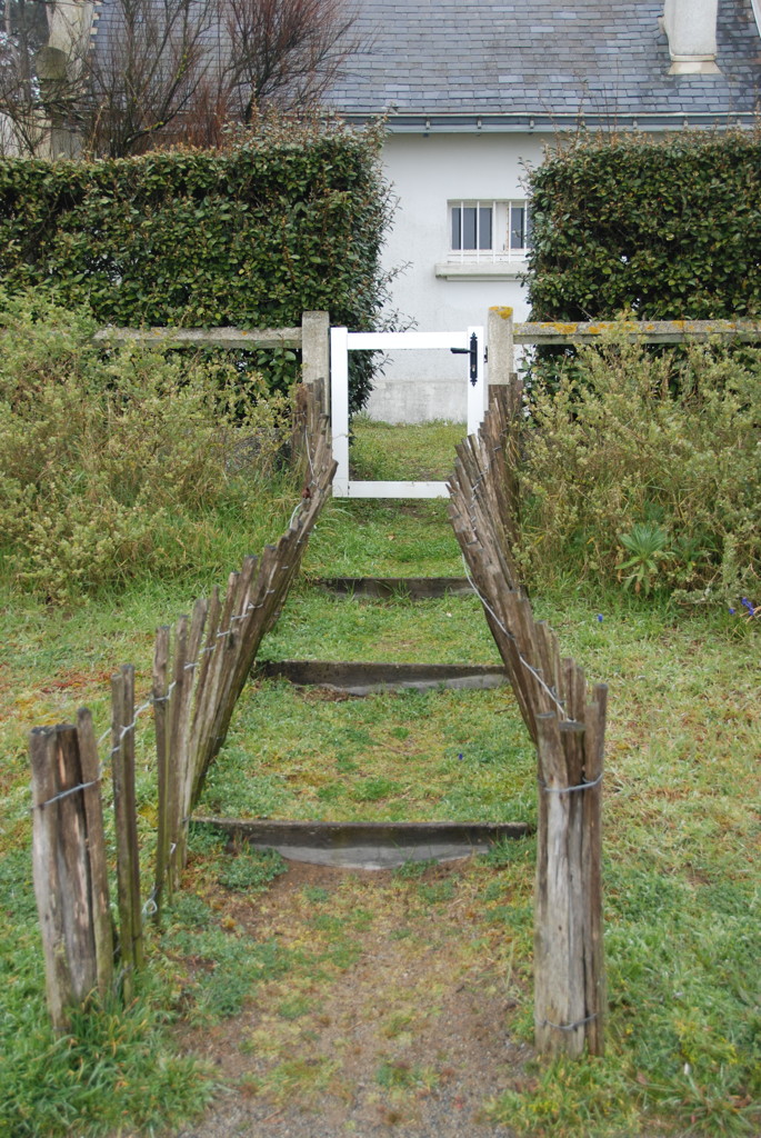
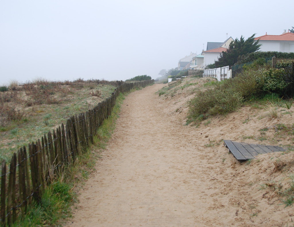
The fort marks the beginning of the chemin cotier that leads along the upper edge of the cliffs and looks down on small, sandy coves. On the map, the way is marked as the chemin des douaniers, the "path of the customs men". This has been smuggler territory for ages, and the douaniers tried to apprehend the boats as the smugglers were unloading their contraband in these coves, hiding it in caves or carrying it up rock steps to get it inland.
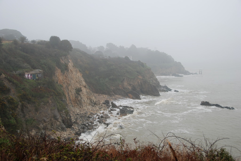
All along the path, the (sometimes splendid) houses of the villages are hidden behind trees and hedges, and today the villages themselves blend into one another without visible borders. Some of the cliffs provide fine outlooks, like the one opposite the Lion's Rock near Porcé.
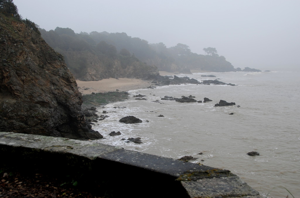
You will have to take detours from time to time because parts of the path are not accessible at high tide, or because of construction work. Sometimes you can descend steps down to the coves, but it is not possible, at any tide, to walk continuously along the surf line. On one of the detours I came across the tour de commerce, a former lighthouse, situated 200 metres inland from the beach.
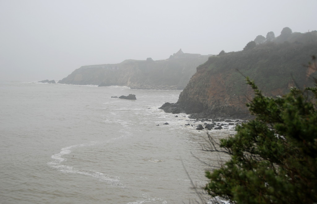
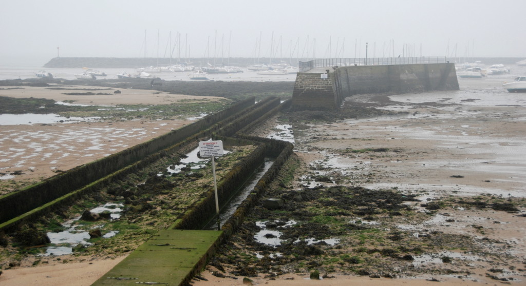
Near Port-Gavy I saw a few more pêcheries, accessible only by steep stairs and rickety piers, and then some more in clusters near Le Petit Gavy and Les Rochelles. Here, the coast runs in a wide curve towards the pointe de L'Eve, always in the same pattern of cliffs, outlying rocks and sandy coves.
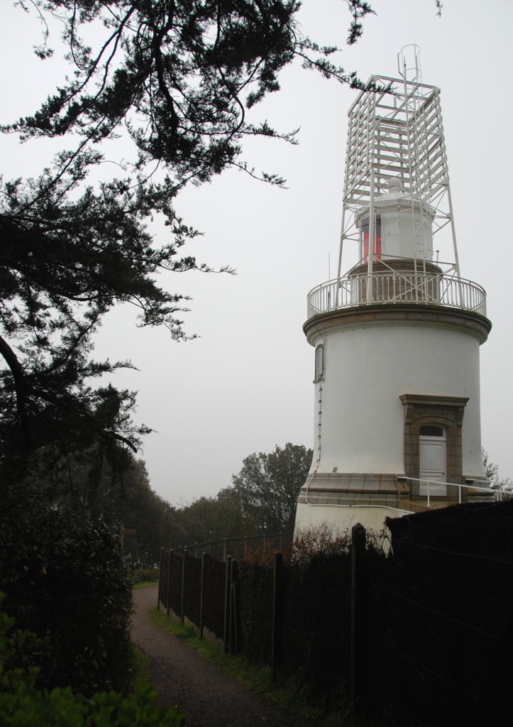
The next landmark is another, modern lighthouse, the phare de l'Aiguillon. The chain of lighthouses forms a complex and interlocking system of navigation aids for the incoming ship traffic; the fact that most of the lighthouses and buoys are still active today, in the age of GPS systems and navigation beams, says a lot about the dangers of this stretch of coast.
The fort de l'Eve is a WW 2 construction, part of the Atlantikwall fortifications you find all along the coast; 75 mm guns were guarding the approaches to the Loire, hidden in concrete emplacements and bunkers disguised as farm houses. Heavy (170 mm) guns and searchlights were positioned a bit inland from the cliff point. The dredged deep-water channel runs very close to this coast, which explains the accumulation of fortifications around this point. Today, the bunkers are sealed and cannot be visited, but there is a museum down the coast, in Batz sur Mer, known as Le Grand Blockhouse in one of the old bunkers that tells the story of this coast from 1939 to 1945.
To avoid the guns at pointe de l'Eve, the planners of Operation Chariot employed light boats of the coastal forces and a destroyer stripped of much of its weight, and they used an "impossible" approach along the southern part of the Loire estuary, across the mudflats outside the shipping channel. The plan required to deliver a masterpiece of navigation and steering in the dark, enemy-infested waters. The gamble worked; H.M.S. Campbeltown and the motor launches were not spotted on their way in and attacked the harbour in a way none of the German defenders had thought possible.
Along the path, and also from the pointe de l'Eve, you can see many small observation, gun and machine gun bunkers built into the cliffs and camouflaged. Graffiti sprayers have taken care of the camouflage by now, usually the bunkers are clearly visible in a coat of red, silver and yellow, even on a day as misty as this.
I am leaving the large plateau of the pointe de l'Eve now, continuing into a stretch of coast famous for its large, sandy beaches.
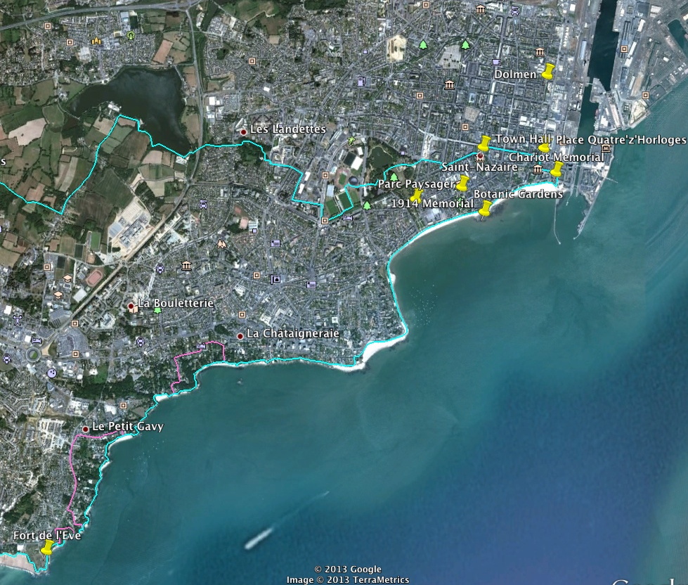
My footsteps on the plage de la Courance

View of the cliffs
Saint Marc sur Mer

Monsieur Hulot
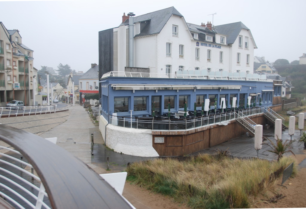
An old gun overlooking the famous beach
Cliffs and beaches in the mist
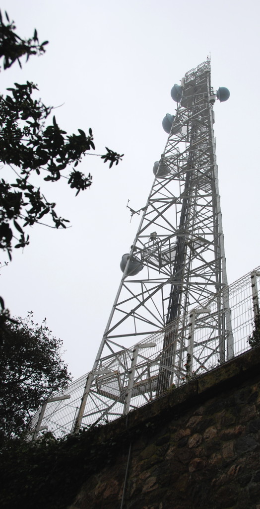
The sémaphore at pointe de Chémoulin
Looking back from the pointe de la Lande (sentier des Douaniers)

A saurian rock
Beach at Sainte-Marguerite
Holiday homes with direct access to the beach
Orientation table at the pointe de Congrigoux
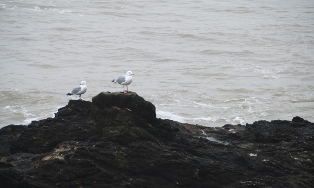
Natural citizens of this coast

Flat rocks near Sainte-Marguerite
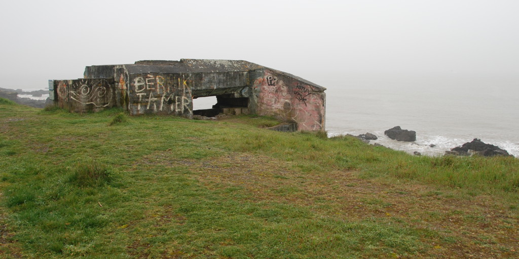
The remains of bunkers litter the coast even here.
Beach promenade, Bonne Source

The first houses of Pornichet proper
The yacht harbour at low tide
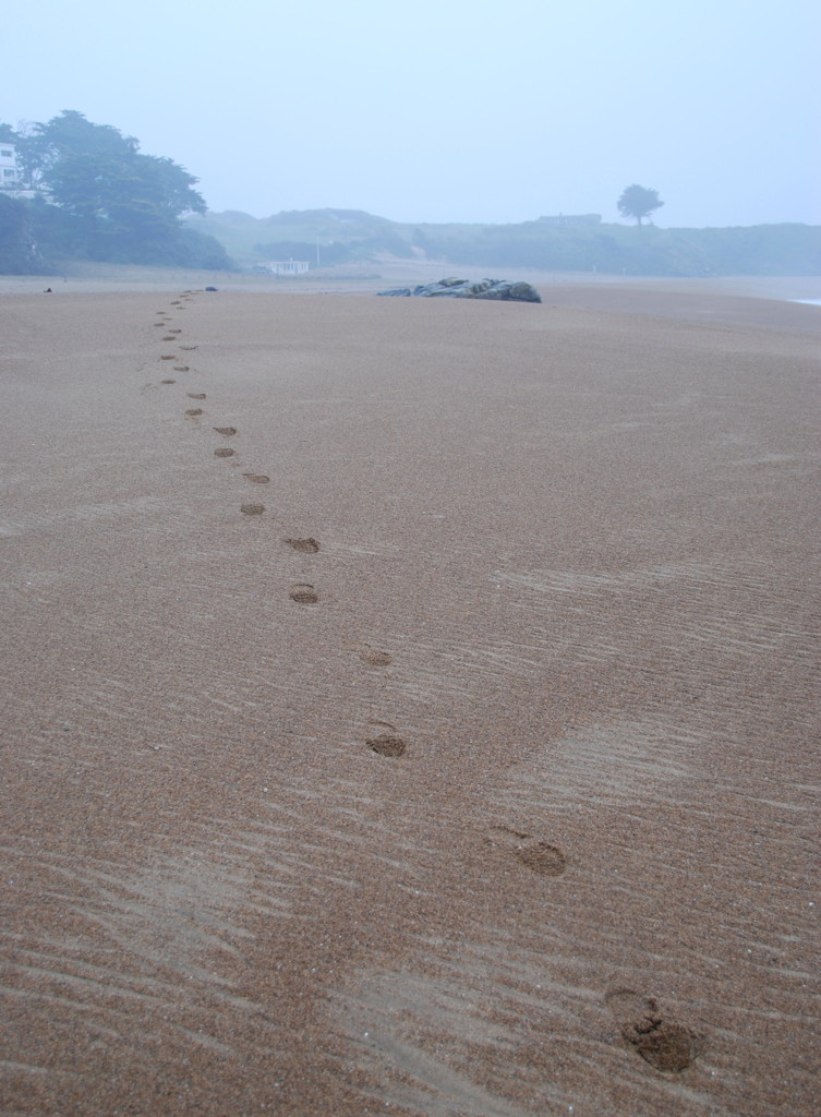
From here, the coast turns into the general direction of west-southwest again; immediately next to the pointe de l'Eve there is the plage de la Courance, a wide and broad beach that already belongs to Saint Marc sur Mer. A short cliff path then leads to the famous beach of Saint Marc proper, immortalized as the "beach of Mr. Hulot" because Jaques Tati's film Les Vacances de Monsieur Hulot was shot here in 1953. A bronze cast of Mr. Hulot still looks out at the sea from the platform above the beach restaurant, in the typical pose you would recognize from far away. Another bronze item, a small cannon, is nearby on the same platform and is another reminder that these have been troubled waters throughout history. At this time of the year (and the day, probably, it was just 9:00) the beach restaurants and bistrots were still closed, and I did not go into the village of Saint Marc sur Mer itself.
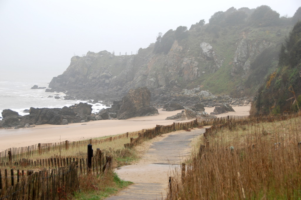
These two beaches are the first of a series that lead to the holiday resorts of Pornichet and, further on and outside my route, La Baule; I will now walk along similar beaches all the way to Pornichet, which is a major seaside resort with a large yacht harbour and three huge beaches of about 2 km length each. The path leads up and down, from cliffs down to beaches and up again, but if you like you can now walk directly at the surf line for long stretches at a time.
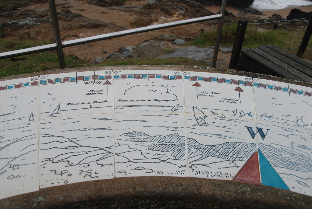
The pointe de Chemoulin is a huge and craggy cliff, topped by a modern signal station; the path turns to the Northwest at this point, and the houses along the coast now show a distinct beach resort flavour, most of them with direct gates to the sandy, promenade-like path. The beaches are broken by cliffs at several points, for example at the pointe de la Lande with the sentier des douaniers, a view point which I suppose was formerly a customs station or lookout and that now is a forest and a sea bird resort, and the pointe de Congrigoux with its vista and orientation table; the latter shows the directions to the nearest beaches, but also to destinations that would be hard to see even in very fine weather– Mexico, New York and Montreal. Then it is beach, beach, and beach again. Finally, a few hundred metres before I come to the Pornichet yacht harbour (pointe du Bec and the chateau des Tourelles), the sand turns into huge rocky flats, ideal for fishing and collecting mussels.
The yacht harbour of Pornichet marks the southern end of its long beaches. It has two parts: a modern dredged deepwater basin, and the old harbour that falls dry at low tide. The path now becomes a wide, paved promenade that runs along the boulevard des Océanides, lined with large hotels on one side and the beach and small bars, shops and surfing schools on the other. Again, most of the shops were still closed at this time.
I leave the coast at the Ibis hotel (av. Poincaré) and head inland.

An old house in Pornichet

The fountain on place Foch
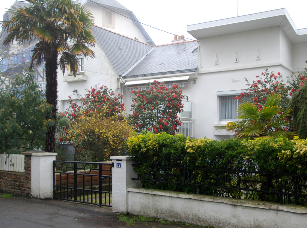
Modern villa…
…and even one in Tuscan style
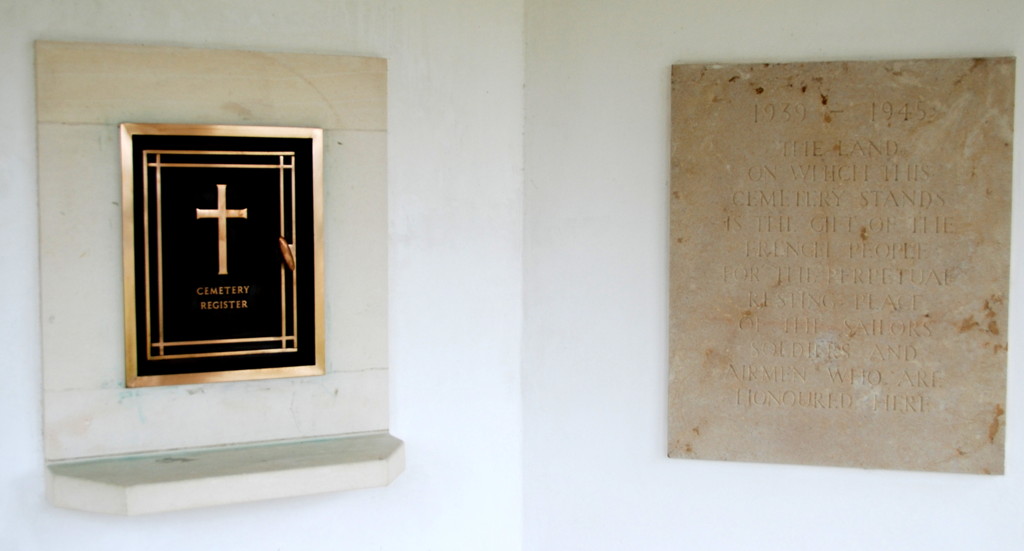
The remembrance pavilion on the war cemetery
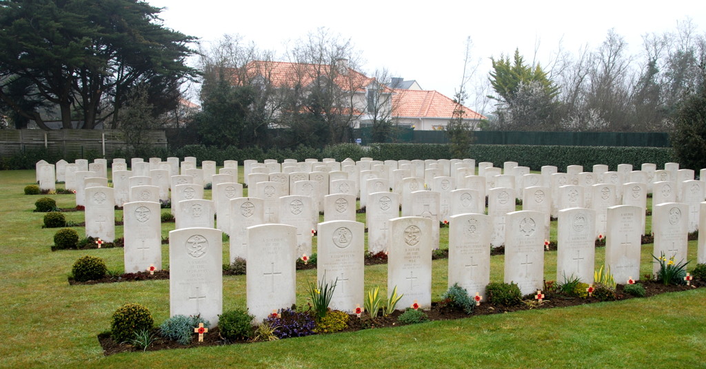
Rows and rows of graves
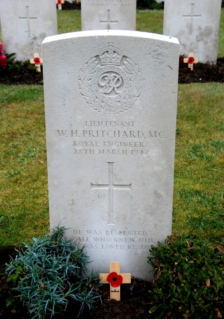
The grave of Ltd. Pritchard, who died in the Old Town of Saint-Nazaire during Operation Chariot
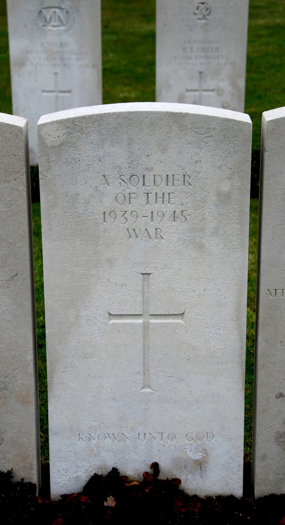
The grave of an unknown soldier
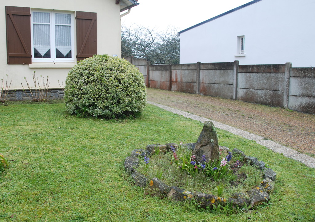
Following the avenue Charlotte I come to to the place Foch, the town centre of Pornichet with restaurants, shops and a dolphin-shaped fountain. The boulevard Auguste Caillard leads north from there; if you turn left at the railroad crossing you come to the train station of Pornichet. This is the half-way point of the hike, and I had a half-hour break in the station building, the first reasonably dry and sheltered place I had found since leaving my hotel in Saint-Nazaire.
While the part of Pornichet south of the railway line is first and foremost a tourist resort, the northern part and Escoublac (again, without a visible border between the two) are sprawling areas of small houses and villas, old and new, some of them quite beautiful, but many also common and not particularly noteworthy. As far as I could see, any route you may want to take would do equally well, my choice of roads was pretty random.
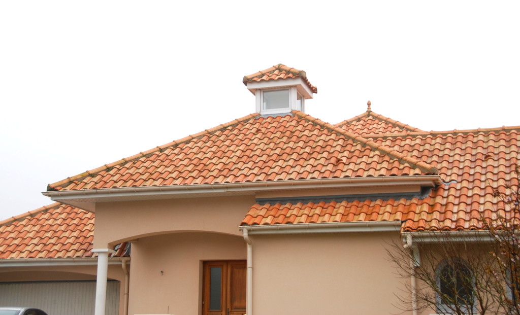
I zigzagged my way through small-town streets towards the destination and turning point of my walk, the British War Cemetery in Escoublac, which is at the corner of the route de la villa Halgand and avenue du close d'Ust.
In 1940, when the first British soldiers were buried here, it was a place out in the fields; today it is near the line where the villas of Escoublac give way to fields and small forests. During the German occupation, French citizens took care of this cemetery, first and foremost a woman from La Baule, Louise Jaouen, who also collected money from the citizens to place a cross on each grave and for a monument, and she even employed a gardener to tend the place. After the war, the mayor of Saint-Nazaire addressed the veterans of Operation Chariot with the words "You were the first to give us hope" (for an end of the German occupation); seeing how the citizens of the region took care of the fallen Allied soldiers I believe the feeling was shared by many, even though raids and the bombardment of the Atlantikwall forts on this coast brought death and destruction to their very villages, directly, or indirectly through German retribution.
About 330 British and a few Polish soldiers, sailors and pilots are buried on the war cemetery, among them 74 that could never be identified. The cemetery is small and meticulously cared for; when I visited it, the 56 graves of sailors and soldiers who died during "Chariot" (i.e. about a quarter of the total British victims of the raid) were marked with small memorial crosses laid there during a remembrance ceremony on March 27th, a few days before my walk. It was moving to read the names on the tombstones, names I knew from reading accounts of the raid, and I spent some time in contemplation there.
Menhir country; size does not matter, it seems.
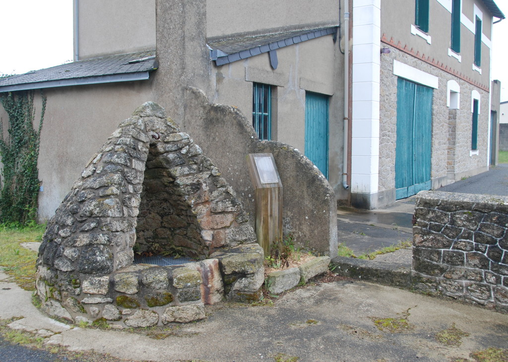
An old well

The path leads on…

…becomes narrower…
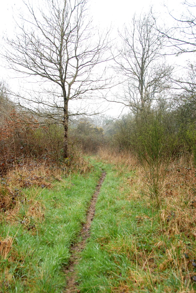
…and narrower.
Am I still right?
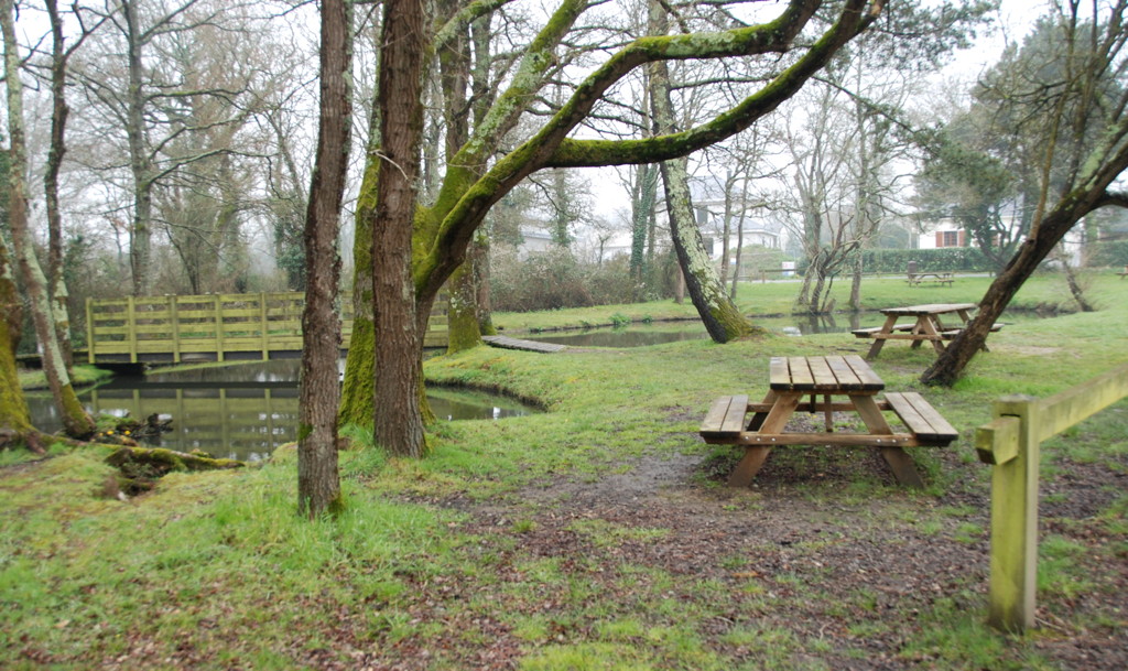
The resting place at Le Forge
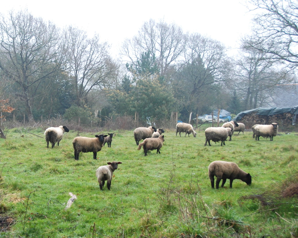
Sheep grazing…

…or watching the surprise visitor.
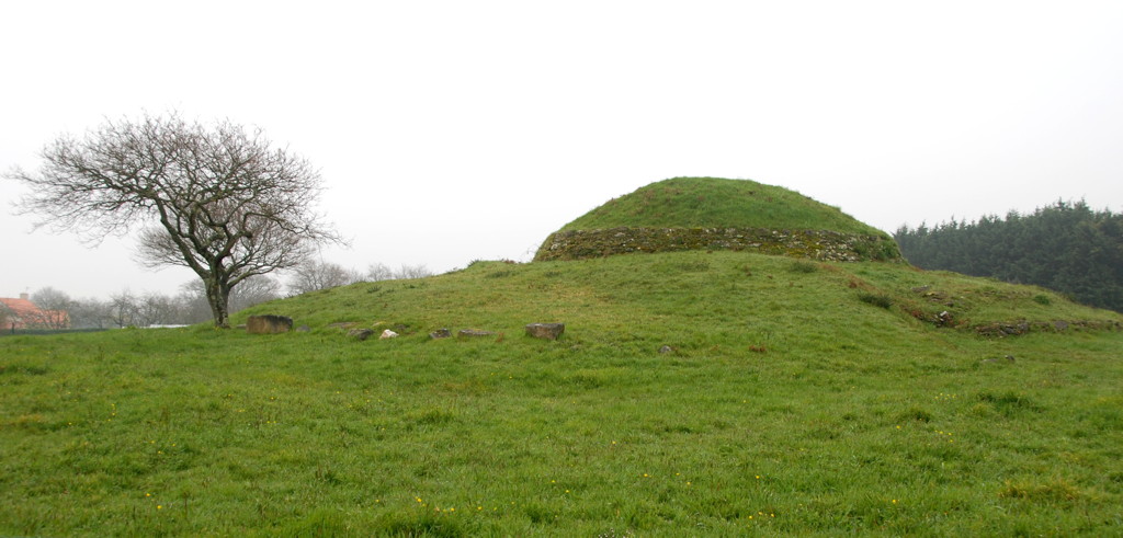
The tumulus of Dissignac
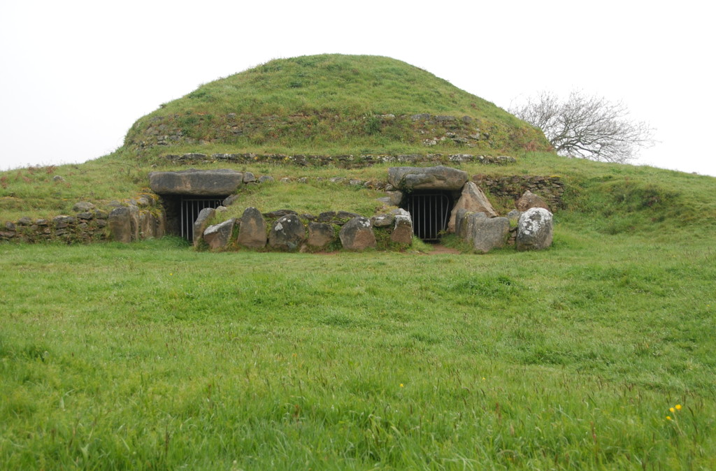
View of the entrance
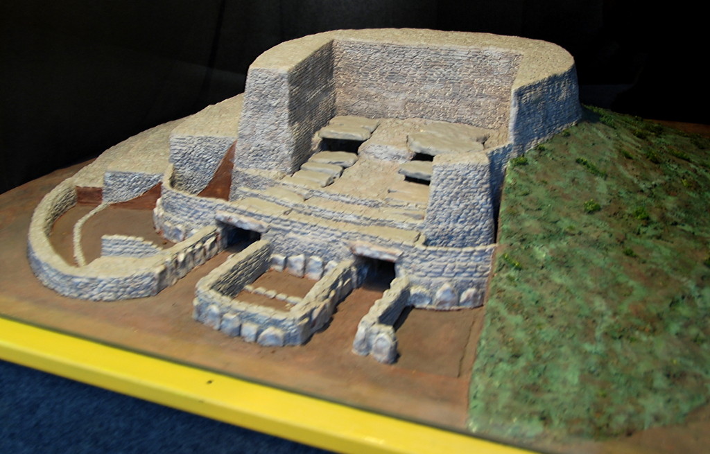
Model of the tumulus at the ecomusée Saint-Nazaire
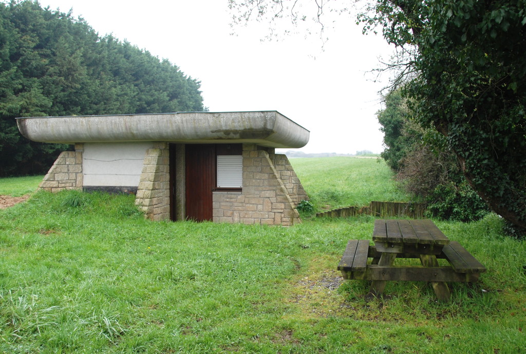
Even the visitor centre is built in megalithic style
The way back to Saint-Nazaire runs in a generally eastern direction. The first stretch again passes through residential areas. Many houses are of recent construction, about half of them single-family homes, the others 2-story blocks scattered loosely around residential streets and parks. Nothing remarkable, but after a while I noticed recurring signs saying "route vélocéan"; by chance, the route I had planned to walk was mostly identical to this bicycle route that runs along the Breton coast.
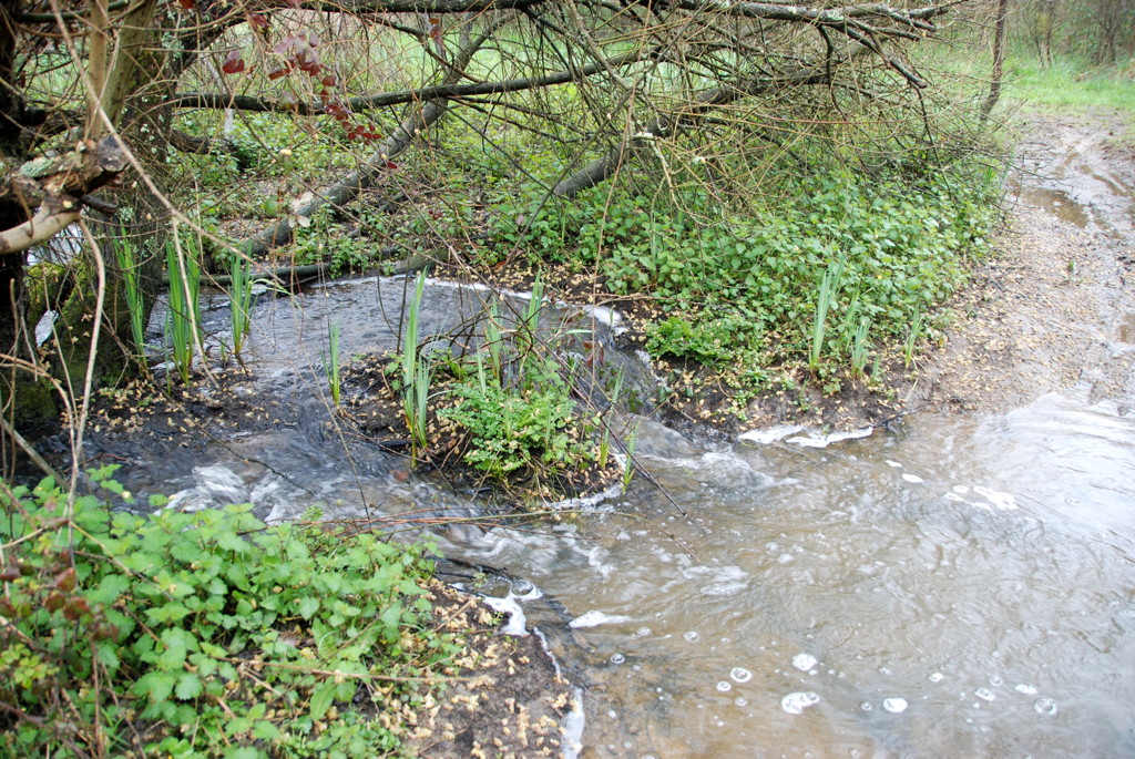
Shortly before crossing the railway and the D392 autoroute I left the houses behind me. I had chosen to go cross-country on footpaths from there, so after crossing the D392 and following it for a short stretch, I went southward into what I thought was the path I had looked for. Well, it was not (see the detour given in the KMZ file), and the next half kilometre or so was a bit of rough going, along trails and through bushes and brambles, crossing a little stream and wondering whether I would end up at some fence or blocking terrain. It certainly made a nice change from the somewhat boring residential areas, and to be honest, it was only a short way back to the next dirt road and farm buildings. From then on I followed the bicycle route again, along small roads and footpaths.
At the village of Les Forges ("the smithies") I found a resting area that seemed to belong to a popular excursion place, at least there were a lot of cars on the parking lot. A good place for some minutes of rest and an attempt to get my socks dry again (I had not crossed the stream quite as elegantly as possible). Also, though the weather had improved vastly since early morning, it now became quite cold, enough to make me get my scarf and gloves out.
For the next few kilometres I again followed the bicycle path through rural country with pastures for sheep, horses and deer.
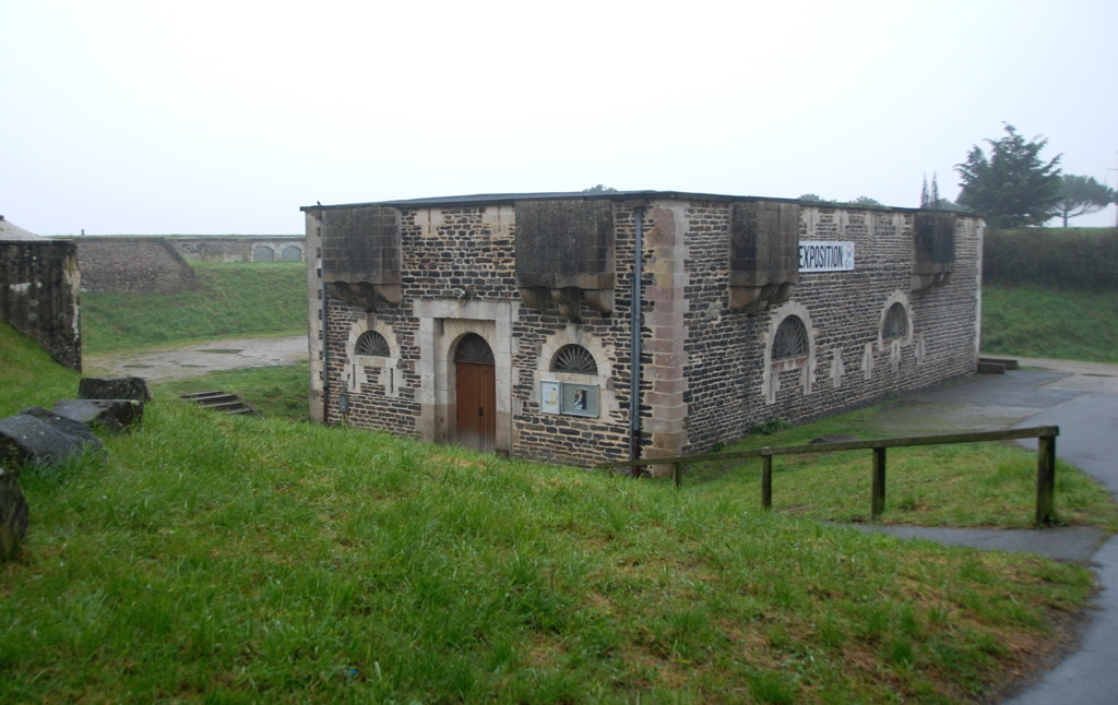
I promised a trail into history, and after pre-Napoleonic, Great War and World War 2 I now go back to the Stone Age: My next stop was the tumulus of Dissignac, a neolithic barrow or burial mound. It is completely fenced in and was not open to visits, but I had seen a model of the interior in the ecomusée of Saint-Nazaire and could imagine what it looked like inside.
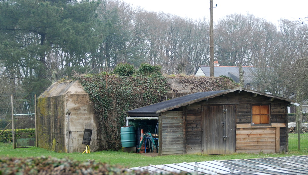
Remnants of the war are put to use

Lake bois Joalland

Optimists about to race
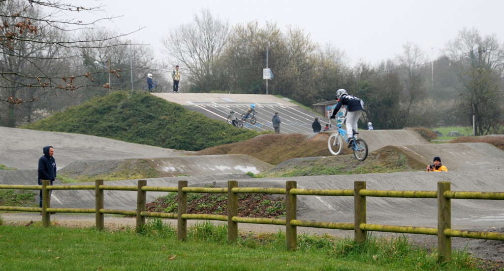
Bicycle training area
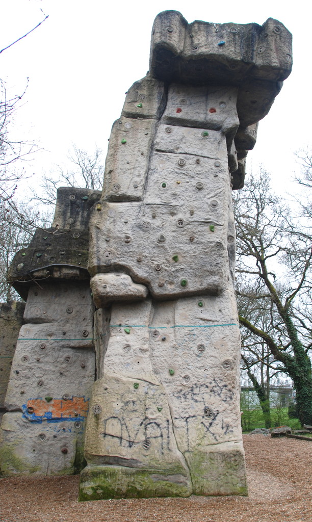
Climbing rock
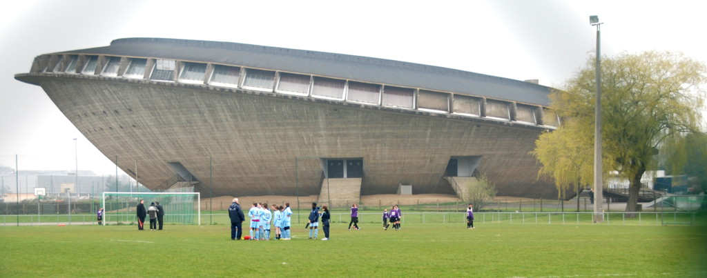
Sports stadium "the saucer"
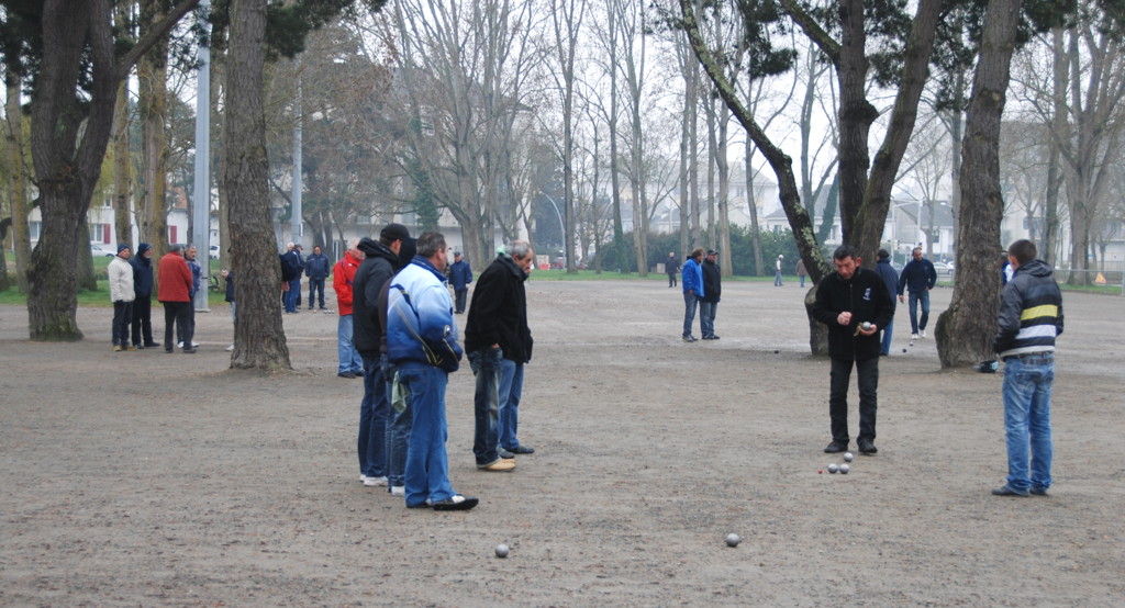
Playing petanque

Parc Paysager

Typical houses built after the war …
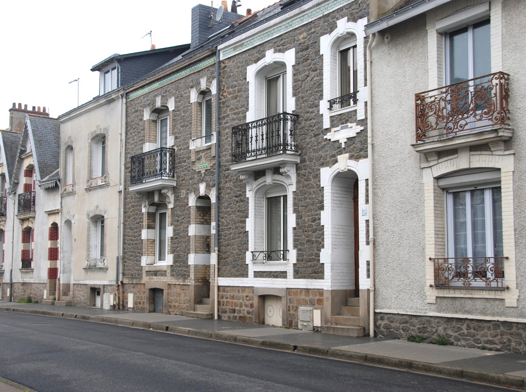
…but a few old houses remain or have been re-built.

The town hall
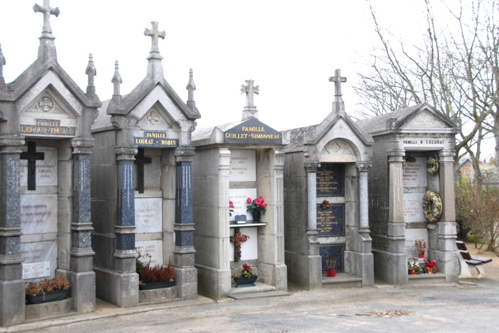
The cemetery
Three more kilometres of bicycle path and small roads got me northwards to the étang du bois Joalland, a lake used by the Nazairiens for boating, swimming and other sports; right where I arrived at the shore is a sailing club, and they were preparing for a children's regatta. A pleasant footpath follows the shore line, past a bathing beach and to a large bicycle training and off-road area, a good place to take a rest again (I was beginning to become quite aware of my feet by now), watching children negotiate the course and exercise jumps.
After crossing the D492 road I was back, more or less, in the town of Saint-Nazaire, though the path continued through a public park for one more kilometre. When arriving at the rue du Docteur Albert Calmette (France is not famous for short street names) I walked through an area of modern, faceless, multistory residential houses that did not quite look as if they were the homes of the haute volée. I had to walk around an industrial and school area (cité scolaire) to arrive at the large sports park because the through ways I had marked were blocked by fences and gates. The most remarkable building of the sports park is the sports stadium called "soucoupe" (saucer), a fitting name for this futuristic building, for it really looks like a saucer or bowl tilted at a rakish angle. It was early afternoon by now; in the sports grounds I saw football teams preparing for their matches, most of them junior teams accompanied by enthusiastic parents.
Just across the avenue Leo Lagrange is the Parc Paysager, another public park. The first thing I saw there was a huge gravel place where dozens of people, mostly middle-aged men, played pétanque (or boule?) expertly. The park has a small lake and a hill which I climbed obediently, not to miss a view.
When leaving the park you are back in the town proper and can follow the rue Auguste Chevenaux and rue Pierre Mendes France to the town hall and then the rue du Général de Gaulle back to the place Quatre z'Horloges, my starting point.
Should you plan to go to the railway station you could turn north at the avenue Ferdinand de Lesseps and boulevard Victor Hugo; on this route you pass the old cemetery, which is really worth seeing. It is built in a peculiar style typical for the region, with a central place around which the graves of the most important families of the town are located. Traditionally, the distance of your grave from this rondel would indicate your social status in the community.
This concludes my account of this long walk. If you liked it, maybe you want to accompany me again on a sightseeing walk through the town and harbour of Saint-Nazaire and Penhoët.
As the author of this page I take no expressed or implied responsibility for the content of external links; opinions expressed on such pages are not necessarily mine. The web space provider is not responsible for the contents of this page or any linked pages.
Written and published by Lutz Pietschker. Please send comments about technical problems to the
site master.
-Made with a Mac!-
, last change 2011-03-12